Saturday, December 22, 2018

Post #148 - 2018 Bike-birding recap!

Real quick - if any of you are thinking about trying bike-birding, have a look at this article from my Seattle friend Bryony Angell. She offers some nice tips to get you started. Now on with the recap!

I haven't written much about bike-birding since my April Big Day, so this is the perfect time to recap my self-powered exploits from 2018. This was my first full calendar year in the Bay Area, and these most recent 12 months were a strong continuation of the bike-birding momentum I built in the second half of 2017 (after moving from Los Angeles). Comparing 2018 to 2017, I ventured into many new areas in my home San Mateo County, and I spent more time exploring neighboring San Francisco and Santa Clara Counties. I also crossed the bay - via the Dumbarton Bridge - to bird Alameda County for the first time this year. Though I didn't keep track of mileage last year, careful accounting revealed I cranked out 1,950 miles of bird-motivated biking in 2018. As it's exactly 800 driving miles on Interstate 5 from the Oregon state line to the Mexican border, I traversed the length of the Golden State more than twice!

Half Moon Bay and Pillar Point


Golden Gate from the Presidio

As far as birds are concerned, I started 2018 with 209 species on my cumulative Bay Area bike list and ended with 271. Among the 62 species I added this year, Tufted Duck on Nob Hill Pond in San Mateo, Ruff at Don Edwards at the bottom of the bay, and a Broad-billed Hummingbird in downtown San Francisco were the most notable. Eastern strays included Yellow-bellied Sapsucker, Eastern Kingbird, Red-eyed Vireo, Blackburnian Warbler, Black-throated Green Warbler, Tennessee Warbler, Palm Warbler, Summer Tanager, and Swamp Sparrow. Seawatching yielded Northern Fulmar, Black-vented Shearwater, Rhinoceros Auklet, and Pomarine Jaeger. Outside of those, a hodgepodge of Long-tailed Duck, Prairie Falcon, Lewis's Woodpecker, Tropical Kingbird, and Northern Saw-whet Owl (heard only) rounded out the year's highlights. 

Note added Dec 29 - Just found Lapland Longspur out on the bay for #272!

Note added Dec 30 - Successful 52-mile round trip Orchard Oriole chase to SF for #273!


Totals for individual counties

Looking ahead, my main goal is to push my cumulative Bay Area total towards 300 species. I don't think I stand a chance in hell of reaching that plateau in 2019, but I hope to make some ground towards that benchmark. The ideal scenario is for new birds to show up near where I live, but I know I am going to have to do a lot of riding to add new species from more distant areas to approach 300. Just for fun, here are the 20 most likely new species for me along the coast (using San Mateo as a proxy). 


Most of the species are offshore pelagics, but I should be able to find Red Phalarope, Black-legged Kittiwake and maybe Cassin's Auklet with seawatching. Black Swift nests at Año Nuevo and will require 2 days (with overnight in Pigeon Point hostel) to collect. Northern Pygmy-Owl will require an overnight in Half Moon Bay since I cannot ride over Route 92 in the dark. Wilson's Phalarope I can find at the bottom of the Bay (Santa Clara) in August. Dipper is sometimes around, but is far from common in either San Mateo or Santa Clara.

The Dumbarton Bridge from Don Edwards NWR


Most productive will be spending time inland and east. The catch is those trips will need to be multi-day since I cannot reach to the eastern edge of Santa Clara (or Stanislaus) and return home in the same day. The best trip I could do would be the below, probably sometime in early May. It would take 4 full days (~220 miles out and back) but give me chances for Swainson's Hawk, Black-chinned Hummingbird, Phainopepla, Roadrunner, Common Poorwill, Lawrence's Goldfinch, Blue Grosbeak, Costa's Hummingbird, Bell's Sparrow, Canyon Wren, and other dry habitat specialists. It's a lot of riding, but I think Mines Road and Highway 130 would be great birding in a beautiful setting. Company would be great - if you've got the legs!


OK, you get the idea. Returns have really diminished, and I am going to have to work very hard to add new species. Outside of those species goals, I'd like to spend some time birding in Marin since it's relatively close. The pipe dream trip would be to take 12-14 days to ride to the eastern side of Sierras in June or July. That journey would take me to areas of the state I haven't visited (even by car) and give me the chance to find 20+ species I'll never find where I live. 

That's it for now. I will try to put together a post on this year's photo highlights, so please stay tuned for that!

Monday, November 26, 2018

Post #147 - Rescuing Brown Pelicans on the Texas Coast!

Why am I holding a Brown Pelican in Texas in the rain? Read on to find out why and to learn a bit about Brown Pelican conservation!


The Brown Pelican has experienced a tumultuous conservation history. Hunted for feathers in the early 20th century, the species suffered additional and near-terminal declines in the 1950s and 1960s at the hands of the insecticide DDT. When concentrated up the food chain and into carnivores such as falcons, eagles, and pelicans, the toxic compound blocked calcium metabolism and caused female birds to lay brittle eggs that cracked and died when incubated. The species was listed an Endangered in 1970 but recovered steadily once DDT was banned in 1972. Since then, the species has experienced a robust expansion and was removed from the Endangered Species list in 2009.

Brown Pelican, San Diego, CA
Taken with my Old Skool Rebel xTi in 2011!

Populations of Brown Pelicans are currently healthy, but individual birds still face a number of human-created challenges. Like many seabirds, pelicans routinely ingest ocean plastics they mistake for food. Those cause all sorts of internal problems, and tangles with fishing tackle and lures often leave the birds with external injuries. Collisions with cars can also be a problem, and it was against particular danger that I volunteered my efforts on the afternoon of November 9, 2018.

Brown Pelican, Half Moon Bay, California, Nov 2017
Canon 100-400mm f/4.5-5.6 IS II on EOS 7D Mark II
1/5000 at f/5.6, ISO 400, Handheld from kayak

We'll need some background to get started. Below is a map of Texas (left) and a detailed view of Highway 48 between Brownsville and Port Isabel (right). Let's focus on the right map. Each morning, thousands of pelicans depart the Roosting Area and fly southeast across Highway 48 to the reach the Feeding Area. They spend the day eating and return to the Roosting Area late in the afternoon. The pelicans have no issues moving between the two areas on most (~98%) days, but the return trip can turn deadly when storm fronts pass through the region. To understand how, we need to talk a bit about wind. What follows is a bit confusing, but the important thing to take away is that storms cause big problems for pelicans.


The prevailing wind on the Texas Coast blows from the southeast (orange arrow, right map above); those usual breezes are weak in the morning and strengthen as the afternoon progresses. That default situation - southeast winds building over the day - is not a problem for pelicans. There's little morning headwind to impede their flight to the Feeding Area, and a stronger afternoon tailwind speeds their return flight to the Roosting Area. However, when low-pressure storm systems move onto the Texas Coast, the wind invariably switches to blow from the northwest. That change creates challenge for the pelicans as they must make the afternoon flight to the Roosting Area into those potentially strong northwestern headwinds. And it's there that an unlikely danger presents.

Wait, what the hell? Am I saying pelicans can't fly into the wind? Pelicans have been flying into the wind for millions of years, so what gives?

Stormy view down Highway 48

It's all about the highway; more specifically, it's all about the two 3-foot high concrete barriers, one that divides the highway and the other protecting the north side of the road from bay spray. Whenever strong, storm-associated northwest winds sweep across the bay and strike those barriers, they create an unidentified sort of air turbulence. That aerodynamic irregularity causes some fraction of pelicans crossing the road in the upwind direction - towards the Roosting Area on stormy afternoons - to lose loft and crash onto the highway where they are struck by cars. We don't understand the precise mechanism, but it's clear sustained headwinds of 20 MPH really affect the birds. When winds push 30 MPH, upwards of 50 or 60 pelicans might be killed by cars. Biologists/Convserationists know the concrete barriers are to blame since wind tunnel experiments have revealed more porous barriers do not create equivalent turbulence. Strong southeast winds cause identical turbulence on most afternoons, but it doesn't affect the pelicans since the birds cross the road and barriers in the downwind direction en route to the Roosting Area. Again, just know storms and NW winds give pelicans problems.

Pelicans crossing Highway 48 into 
afternoon NW headwinds.

Since the pelicans only have problems on the rare occasions with strong, storm-associated NW winds, locals watch the weather and spring into action when those conditions present. Police drive slowly to create 'rolling roadblocks' from 3pm to 6pmon those afternoons, and biologists and conservationists line the shoulder to scoop up whatever pelicans crash onto the highway. It's a highly coordinated effort and has significantly cut pelican mortality in the last few years. As the specified conditions only present ~6 times a year, mostly between December and February, the community has been very understanding of the protective measures whenever it storms.

Rolling rockblock on Highway 48.

For better or worse, the specified conditions presented while I was attending the Rio Grande Birding Festival in South Texas earlier this month. I volunteered to help rescue pelican, and that's how this blogpost came to be. Our group ended up rescuing around 15 pelicans that afternoon. Sadly, there were at least 3 carcasses on the road the following morning. Those presumably belonged to straggling birds that hit the roadway after the rolling roadblocks ended and volunteers departed. Below are a few of the birds we saved.

Pelicans on Highway 48. The lowest
flying birds usually ended up on the road.
Once on the road, they can't take off.

Volunteers scoop a pelican up and carry it
across the road. My phone died before they let it
go on the other aide of the barrier! The birds
are totally fine once safely over the second of
the two barries 

Biologists Stephanie Bilodeau and Jessica Something
holding rescued Brown Pelicans

As awful as the situation was, I was happy to lend a hand and learn something about the rescue efforts. Everything humans do has a consequence for wildlife, and objects as seemingly insignificant as concrete road dividers can have unanticipated and deleterious effects on the animals with which we share the world. However, efforts such as those described above show there are people who care enough to help the birds on such days. Highway administrators are apparently open to the possibility of replacing the concrete barriers, so maybe the situation will improve in the future. It's a government bureaucracy and will take time, but it's a step in the right protective direction.

That's it for now, cheers!

Wednesday, October 24, 2018

Post #146 - Colombia - Southwestern Andes - Nariño

Quick note - This is meant more as a permanent online reference than it is a quick blogpost, so it is very long and detailed. This account - as well as summaries from all the places I've visited, Colombian or other - will be archived in the International Birding Resources tab under the main banner header of this blog. I hope you will use that resource to plan your own birding adventures!

Outline

Nariño Introduction
Geography

Nariño Logistics
Getting there
When to visit
Where to stay
Guides

Key Nariño birds
Colombian endemics
Chocó endemics

Nariño birding sites
Páramo Bordoncillo
Laguna La Concha
Laguna Cumbal
La Planada
Río Nambi
Kilometer 42 and Finca Maragricola
Around Tumaco


Tyrian Metaltail is found at higher Nariño elevations
Canon 500mm f/4 IS + 1.4x III on EOS 5D Mark IV
1/500 at f/7.1, ISO 1600

Introduction
Nariño is a wild and mostly unexplored department in Southwestern Colombia, right on the border with Ecuador. Though is was for a long time an active conflict area and stronghold for the FARC guerillas, the department - mirroring Colombia as a whole - has recently stabilized and opened to international tourists. Nariño encompasses habitats from Andean páramo to lowland rainforest, and more than 1,200 species of birds have been recorded in the department, a municipality about the size of Maryland. However, Nariño's great birding doesn't come easily, and extra planning is required to overcome challenges stemming from a general lack of infrastructure. This post will highlight the areas I visited in the summer of 2018, and I hope the accounts of my travels will streamline logistics for future Nariño visitors. I'd also suggest visiting the Birding Nariño Facebook Page (run by Nariño birder Cristian Flórez-Paí). It has some additional information and offers a forum for visitors to connect with local birders.


Geography
To fully understand Nariño, we must first understand something about the Andes. Almost everyone knows the Andes run north through Chile and along the western reaches of Bolivia, Peru, and Ecuador. What fewer know is the range trifurcates into 3 distinct cordilleras soon after crossing into Colombia. That unusual geography - coupled with Sierra Nevada de Santa Marta on the Caribbean Coast - has facilitated a very high degree of localized speciation in the Colombian mountains. That all but a few of Colombia's 78 endemic bird species are confined to the mountains (Andes or Santa Martas) or the valleys they define speaks to this phenomenon. 


As good as Nariño's birding is, it's not a good place to look for those endemics for two reasons - one arbitrary and one geographic. First, human drawn lines have juxtaposed Nariño and Ecuador, so Nariño shares virtually all of its birds with that neighboring country. Second, the Andes haven't trifurcated in Nariño, so the region hasn't experienced the same high degree of speciation as have other mountainous areas in Colombia. The single cordillera that will split to yield the Western and Central branches is labeled as 'WestCentral Andes' on the above map (the eastern branch splits off farther northeast, in Huila). However, what Nariño lacks in Colombian endemics it more than redeems with Chocó Bioregion endemics, regionally specialized species inhabiting the Pacific slopes of Colombia and Ecuador. Accessing Nariño's Pacific slope is fairly straightforward (with a few caveats), so it's as good a place as any to observe Chocó birds. I'll have more to say about the Chocó in the 'Key Nariño birds' section below.


Nariño Logistics
Getting there
Nariño is best visited in conjunction with Valle and Cauca, the departments just to the north, for several reasons. First, Pasto's airport doesn't handle international traffic and will require a connecting flight to reach. Second, rental cars aren't available at Pasto's airport; individual people or couples who want to explore Nariño without joining a tour or hiring a driver will have a hard time doing so from a Pasto arrival point. Third, there is dynamite birding in Valle and Cauca, and visitors to Southwestern Colombia are going to want to spend some time in those departments. Cali has a great airport, and it's easy for birders to rent cars at that international gateway. My suggestion would be to spend 6-7 days around Valle/Cali (Post #144) before heading south to Cauca/Popayán (Post #145) for 3-4 days. From there it would be easy to continue south into Nariño/Pasto for an additional 4-5 days of birding. 

While renting a car in Cali is a totally viable option, many visitors hire a driver with his own vehicle instead. The daily rate varies with the size of of the vehicle and includes the gas and the driver's lodging and food since he'll be traveling with you. It might sound expensive, but it's hardly more than renting a car. Contact Jovani Flórez at Solutions in Colombia (solutionsincolombia@gmail.com, Whatsapp +57 311 227 1259 or +57 320 835 9104). They are the 'go-to' for Colombian birding transportation and have experience carting birders all around the country. 

When to Visit: 
Short Answer: December through February, July and August 
Long Answer: Rainfall is the primary consideration when planning a visit to Cauca, Colombia, or anywhere in the tropics, and the graphs below show the average monthly rainfall in Pasto (2,500 meters, 8,300 feet) and Tumaco (sea level). This data was obtained from this website. It's actually really cool, so check it out for more information.


You can see rainfall patterns are very similar in the mountains and on the coast. This is nice as you don't have to play elevations against one another during your visit. The paramo at 11,000 feet (nearly 3,000 feet above Pasto) will probably be driest December-February (during the true Andean summer), so that's one consideration. Also remember that Nariño will probably be visited in conjunction with Valle and Cauca, and those are best visited December-February. They are also nice July-August, but weather at very high (páramo) elevations is more variable July-August than it is December-February. Beyond those considerations, two others factors need be considered. First, the inter-Andean valleys in Valle and Cauca are hottest during July-August, so that might dissuade some travelers from visiting in that window. Second, the North American neotropical migrants are present October through April, so total trip lists will be higher December-February than they will in July-August. 

Where to stay
Pasto is a modern city and has many suitable accommodations, but lodging options decline steeply from that central point. There are some decent beach hotels in Tumaco, but that incredibly poor and run-down city offers visitors nothing beyond lodging. La Planada - perfectly positioned halfway down the Nariño's Pacific slope - is a very minimal ecolodge requiring travelers to make significant comfort sacrifices (more on this later). Rather than present all the lodging options here, I'll cover them in the context of the birding sites discussed below. 

Guides
At writing, there are no local birding Guides in Pasto, but that will surely change as demand for them increases. The Audubon Society is working to train locals to serve as guides as you read this. For now, it would be easy to hire a Cali-based guide and have him/her accompany you south to Nariño after time in Valle and Cauca. I've worked extensively with Ibagué-based Hernan Arias and highly recommend him. He knows all the birds, had amazing ears, is familiar with the entire country, speaks English fluently, and is an all around great guy. You can contact him at hedarar@yahoo.com or at +57 318 385 3676.

Violet-tailed Sylph is a Chocó endemic found in Pacific Nariño
Canon 500mm f/4 IS on EOS 5D Mark IV
1/400 at f/5.6, ISO 1600

Key Nariño Birds
As Narino has been historically under-birded, it's difficult to get an accurate picture of the the distribution of birds in the department. There is some coverage in eBird, but not so much to know what's surely present versus surely absent at most sites. I've done my best to synthesize information from eBird and various field guides, but what I present here is far from infallible!

Though Nariño hosts some Colombia endemics on edges of their usually more interior ranges (Colombian Chachalaca, Apical Flycatcher, e.g.), birders should not focus on endemics in Nariño; any Colombian endemic found in the department will be more easily found in Valle or Cauca anyway. Beyond a handful of high elevation páramo species that can be found outside Pasto (see Páramo Bordoncillo below), birders should concentrate on the many Chocó endemics inhabiting Nariño's Pacific slope.

The Chocó claims 70-some endemic bird species, and at least 50 of those occur in Nariño, many of which overlap with those found on Valle's Pacific Slope at Anchicaya: Dusky Pigeon, White-whiskered Hermit, Long-tailed Sylph, Velvet-purple Coronet, Hoary Puffleg, Toucan Barbet, Rose-faced Parrot, Nariño Tapaculo, Pacific Flatbill, Long-wattled Umbrellabird, Club-winged Manakin, Scarlet-and-white Tanager, Indigo Flowerpiercer, Moss-backed Tanager, Rufous-throated Tanager, and Yellow-collared Chlorophonia. However, Dark-backed Wood-Quail, Orange-fronted Barbet, Plate-billed Mountain-Toucan, Plumbeous Forest-Falcon, Ochraceous Atilla, and Scarlet-breasted Dacnis do not reach as far north as Valle, and special effort should be made to find those mostly-Ecuadorian species in Nariño.

Dusky Chlorospingus - a Chocó endemic
Canon 500mm f/4 IS on EOS 5D Mark IV
1/250 at f/4, ISO 2000 

Nariño Birding Sites
Páramo Bordoncillo (eBird Hotspot)
An hour above Pasto and right on the Nariño-Putamayo border, Páramo Bordoncillio (3,200 meters, 10,500 feet) offers great high-elevation birding - with a few access caveats. Road 10 is in great shape, and birders can just pull off at the trailhead (which is frustratingly unsigned). From there, a rudimentary and dreadfully maintained track leads through some cow pastures before assuming a pitch so steep that only those birders in very good shape will be able to continue, especially with the very thin air at that elevation. There are certainly birds on the lowest reaches of the trail, but climbing higher into the habitat will increase the chances for Rainbow-bearded Thornbill, Golden-breasted Puffleg, Glowing Puffleg, Tyrian Metaltail, Tawny Antpitta, 5 species of tapaculos (Ash-colored, Spillman's, Blackish, Páramo, and Ocellated), White-chinned Thistletail, Agile Tit-Tyrant, Brown-backed Chat-Tyrant, Pale-naped and Slaty Brushfinches, Golden-crowned Tanager, Blue-backed Conebill, and Scarlet-bellied, Hooded, Lacrimose, and Buff-Breasted Mountain-Tanagers. Most prized at Bordoncillo are Chestnut-bellied Cotinga and Masked Mountain-Tanager, two species with very restricted ranges within the mountains of Colombia and Ecuador. Bordoncillo is technically private and there is supposedly an entry fee, but I'm not sure how one contacts the people who run/own it. There is a very small dwelling at the trailhead, so maybe by knocking on the door (better know Spanish)?!?! These are the sorts of organizational challenges Nariño presents, particularly as many of the best birding sites are on private land owned by people without modern communications (cell phones, webpages, emails).


Laguna de La Concha (eBird Hotspot)
Just down the hill from Bordoncillo at 2,800 meters (9,200 feet) is Laguna de La Concha, a great place to add a few water birds to your Colombia list. I'd recommend focusing on the northern shore. Birders will find a road (Via Laguna de la Concha) that runs through Puerto del Encanto (photo below) and out into the marsh. Yellow-billed Pintail, Andean Duck, Slate-colored Coot, and Andean Gull, Grassland Yellow-Finch are always in the area. It's also possible to hire a boat for a ride, but it's doubtful that will add many birds that can't be seen from shore. Likewise, a quick visit to the Santuario de Flora Isla Corota might be fun but is more for the experience than for any specific birds. Pastures and secondary woodlands surrounding the lake hold Andean Guan, Green-tailed Trainbearer, Sword-billed Hummingbird, Azara's Spinetail, Sierran Elaenia, Red-crested Cotinga, Yellow-rumped Cacique, Slaty Brushfinch, and a variety of other High Andean birds. Birding-wise, the lake is worth 3-4 hours, at most. Overnight stays will be more geared to relaxation.


There are a number of lodging options around the north end of the lake, but Waira (Facebook pageAirbnb listing) is great for groups of 2-4 people. Jorge (photo below) is quite the character. He is super friendly, speaks English fluently, and is a ton of fun. He even has his own boat to run guests around the lake. From Puerto El Encanto, his place requires 25 minutes on a bumpy dirt road, but that could be done in a standard car at a slow speed.


Laguna Cumbal (eBird Hotspot)
Cumbal is 2.5 hours southwest of Pasto and less than 5 miles from the Ecuadorian border. Though it's quite small, there is at least one basic - but decent - hotel in town, and from that base birders can explore Laguna Cumbal (3,400 meters, 11,150 feet) in the shadows of Volcan Cumbal (4,700 meters, 15,400 feet). Given its remote proximity, Cumbal hasn't received much coverage, so it's difficult to know exactly what birds are present. Regardless, the small and undeveloped lake is really beautiful and worth hiring a boat to explore. A 15-minute ride will carry visitors to Santuario de Capotes (fun video), a small environmental facility from which the páramo can be intimately explored via a series of hiking trails. Birders might find Shining Sunbeam, Sapphire-vented Puffleg, Golden-breasted Puffleg, Purple-backed Thornbill, Viridian Metaltail, Cinereous Harrier, Tawny Antpitta, Brown-backed Chat-Tyrant, Scarlet-bellied Mountain Tanager, Cinereous Conebill, Black-crested Warbler, or Chestnut-capped Brushfinch. There is lodging at the facility, but it's very basic and probably best suited to the most adventurous. It's also possible to bird some of the rural roads to the south and west of the lake. Those run mostly through pastures and secondary habitat and offer a nice complement to the birding right at the lake.

View of Laguna Cumbal from west, Cumbal Páramo at Capotes

The FARC is gone from Cumbal, but not forgotten...

Reserva La Planada (eBird Hotspot, website)
La Planada was my favorite place I visited in Nariño, but it comes with a few caveats. Importantly the birding isn't one of those, and nearly 300 species have been eBirded from the expansive reserve at 1,800 meters (5,900 feet) on Nariño's Pacific Slope.


Resident Chocó birds include Violet-tailed Sylph, Hoary Puffleg, Toucan Barbet, Plate-billed Mountain-Toucan, Dusky Pigeon, Nariño Tapaculo, Pacific Flatbill, Club-winged Manakin, Indigo Flowerpiercer, Glistening-green Tanager, and Dusky Chlorospingus. Scarcer and most prized are Dark-backed Wood-Quail, Plumbeous Forest-Falcon, and Fulvous-dotted Treerunner. Beyond those and other Chocó specialties, a wide variety of mid-elevation species will keep birders occupied from dawn til dusk. It would be easy to spend 2 or 3 full days at La Planada, and it's here that the caveats must be mentioned.

There is lodging at La Planada, but it is very basic. My room had only a bed, pillow/blankets, and a light bulb. I didn't care as I am a minimalist by design, but at least one of my travel companions remarked at the lack of curtains/privacy. The bathrooms are separated from the bunkhouse and require clothes and shoes to reach, a particular headache in the middle of the night. The bunkhouse also requires a 400-yard walk down a rather rough trail - with luggage. I was fine with my backpack, but access will a pain for anyone with a rolling suitcase. There is a very basic 'restaurant', but guests eat whatever the staff is having (eggs/chicken, rice, plantains, and not much else). The access road is also steep and in pretty poor shape, and I suspect that reaching the reserve/lodge would impossible without high-clearance and very difficult without 4-wheel drive.


Yes, the accommodations at La Planada are basic, but visitors will be rewarded with wonderful habitat and birds. I really like minimal places like this, but I realize it may not be for everyone. I just want people to know what to expect before they arrive.

Río Nambi (eBird Hotspot)
Just 25 Km down/west on Highway 10 and 600 vertical meters (2,000 feet) below La Planada is Río Nambi (1,200 meters, 3,900 feet). There's not much to it, just a rather poorly-maintained trail leading into the habitat from the roadside. There's no visitor's center or information kiosk at the trailhead, but there is a fun mural on the side of a shed showing some of the reserve's birds, Toucan Barbet and Indigo Flowerpiercer among them. The trail leaves from that spot.


Other residents include White-whiskered Hermit, Velvet-purple Coronet, Long-Wattled Umbrellabird, Scarlet-and-white Tanager, Moss-backed Tanager, and Yellow-collared Chlorophonia, all Chocó endemics. Beyond those, birders might encounter more widespread species such as Golden-headed Quetzal, Masked Trogon, Broad-billed Motmot, Rufous-rumped Antwren, Zeledon's Antbird, Scaly-throated Foliage-gleaner, Golden-winged Manakin, Dusky Chlorospingus, Common Chlorospingus, and nearly 300 others.

The Nambi trail was very muddy and slippery when I visited, but it was wide and easy to follow. It's 3Km (I think) to the research station at the top of the reserve, but I'd suggest birders stick to the lower reaches. The facility/restaurant at the top isn't a 'must-see', and there's no great view from it as there is from La Planada. So, if you have the time and energy it might make a nice - but long - walk. Otherwise bird to the first rest hut and then turn around.

Cristian Flórez-Paí, the Nariño birder who runs Birding Nariño Facebook Page, is currently constructing a small ecolodge, Aves y Flores ('Birds and Flowers'), just down the road from Río Nambi. When completed, it will be a great place from which to explore Nambi, La Planada, and sites lower on the Pacific Slope. Cristian is a really good resource, and I know he would be happy to answer whatever Nariño birding questions you might post on the Facebook page (brush up your Spanish!).

Kilometer 42 / Pueblo Nuevo 
This spot and the next (Finca Maragrícola) are private properties very low on the Pacific Slope (basically at sea level) that are just opening to foreign birders. There is frustratingly little information as to how to access either spot, so I am going to provide what information I have. The locations of both spots, as well as La Planada and Río Nambi, are shown on the map below.


Km 42 is just a dirt road running west off of Highway 10, just before you pass through the small town of Pueblo Nuevo en route to Tumaco. The road is in decent shape and runs ~6-7Km southwest until it dead ends into a river. The habitat is mostly cecropia-dominated secondary growth, and we found all sorts of great birds as we made our early-morning way along the dirt track with a mix of walking and driving. Highlights included Gray-headed Chachalaca, Ecuadorian Ground-Dove, Hook-billed Kite, White-necked and Pied Puffbirds, Black-cheeked Woodpecker, Chestnut-backed Antbird, Purple-throated Fruitcrow, Cinnamon Becard, and Black-faced Dacnis. Bird of the morning on my visit was Orange-fronted Barbet, a Chocó endemic that just makes it over the Ecuadorian border into Nariño.

As there isn't an eBird hotspot for the area, here is a link to my full checklist. Despite repeated attempts to track down the identity of the owner, I have only unearthed a phone number with no name to put to it, +57 315 765 9949 or +57 323 456 1782. The birding at Km 42 was really good, but these are the sorts of frustrations one routinely experiences on Nariño's Pacific slope. Nothing is organized or easy. Those interested can also try to contact Cristian though the Facebook Page. So, yeah, you really have to want to bird the area to make all the logistics worthwhile. Hopefully this will improve moving forward, but it is what it is for now.

Finca Maragrícola (eBird Hotspot)
This site offers similar low elevation birding to Km 42 but is slightly better organized, probably because the land is minimally administered by some university. It too is a dirt road leading away from the Highway 10 roadside and into some habitat, and nearly 260 species have been eBirded along its ~3Km length. My visit yielded Little Tinamou, Greater Ani, Pacific Parrotlet, Pale-legged Hornero, Masked Water-Tyrant, and White-bearded Manakin. The back reaches of the road explore some watery impoundments, and on those we found White-cheeked Pintail, Purple Gallinule, White-throated Crake, Wattled Jacana, and a nice mix of waders and shorebirds. Angel Guevara (+57 317 758 9154) is the contact person for Maragrícola if you want to arrange a visit. The birding at Maragrícola is really good, and - assuming you can get permission and the logistics squared away - is super easy to reach from Tumaco (20 mins). NOTE: Maragrícola and Km 42 (Pueblo Nuevo) get very hot and humid by late-morning, so ideally they should be visited on consecutive mornings from a Tumaco base.

Tumaco
Without sugar coating it, Tumaco is incredibly poor and will be of zero interest to birders. Because of a general lack of tourism infrastructure everywhere on the Nariño's Pacific Slope, the city is a necessary stopover if you want to visit the coastal reaches of the department. I'd suggest overnighting at the Hotel Los Corales on the beach. It's a bit of a pain as you will need traverse the entire city to get into or out of town, but there just aren't other options.

Staying on the beach will offer at least some diversionary birding in the time between visiting Km 42 and Maragrícola. We found Royal Tern, Blue-footed Booby, Yellow-crowned Night-Heron, Ringed Kingfisher, and a few others waterbirds in front of the hotel. The Tumaco airport isn't far away and offers chances for Chestnut-throated Seedeater and Peruvian Meadowlark, two species that barely make it into Colombia/Nariño from Ecuador and countries south. I would bird Nariño's Pacific slope as a one-way endeavor and fly out of Tumaco to get back to Cali or Bogotá.

Chestnut-throated Seedeater in Tumaco
Canon 100-400mm f/4.5-5.6 IS II on EOS 7D Mark II
1/1600 at f/7.1, ISO 1600

Summary
So, that's what I have to offer on Nariño at this time. It should be clear to everyone that Nariño presents great birding but logistical challenges to match. Those hurdles will be lowered as more people visit the department, and birders who visit in the meantime will provide the economic incentive to make those improvements. As I said, I'd couple 4-5 days in Nariño to 10-12 days in Valle and Cauca. That would make for a wonderful sampling of Southwestern Colombia and easily net between 300-400 birds, depending on enthusiasm levels.

This concludes this series of Colombia posts. I may put together a combined Huila/Tolima post at some point, but I have some other writing that is more pressing at this time! Please share this around. I think it's a really good resource, and I hope people will find it useful!

Friday, October 5, 2018

Post #145 - Colombia - Southwestern Andes - Cauca

Quick note #1 - This is meant amore a permanent online reference then it is a quick blogpost, so it is very long and detailed. This account - as well as summaries from all the places I've visited, Colombia and other - will be archived in the International Birding Resourced tab under the main banner header. I hope you will use that resource to plan your own birding adventures!

Quick note #2 - If you like this content, please considering signing-up to follow this blog. You'll get each post emailed to you (no more than 1 per ~10 days), and I'll get a better understanding of my audience. You can follow the blog in the right hand column under the 'Follower' section beneath the blog archive. OK, on with the show!


Andean Condor at Puracé National Park
Canon 100-400mm f/4.5-5.6 IS II on EOS 5D Mark IV
1/1600 at f/5.6, ISO 800

Outline

Cauca Introduction
Understanding Cauca's bird diversity
A Popayán-centric appraoch

Cauca Logistics
When to visit
Getting there
Where to stay
Guides

Key Cauca birds
Colombian endemics
Páramo birds

Cauca Birding Sites
Hacienda Anton Moreno 1760
Ecoparque Rayos del Sol
Road 26 between Totoró and Itza
Puracé National Park
Bosque Leguaro
Hacienda Versalles

Cauca Introduction
With over 1,900 bird species, Colombia outpaces all other countries in avian diversity. Incredibly, ~1,300 of those species have been recorded in Cauca, a department just larger than the state of Massachusetts. I recently visited Cauca for the first time, and I will use this post to highlight the areas I birded. Cauca was a stronghold for FARC guerrillas during the 1990's and early 2000's, and very few birders visited the department during those tumultuous years. However, with increased political stability and the associated Colombian Peace Process, the department is now safe for travel. I consider myself lucky to have visited this wonderful area, and I hope other birders will discover its avian riches in the upcoming years.

A visit to Cauca couples particularly well to both the more developed Valle del Cauca Department to the north and the less developed Nariño Department to the south. It would be easy to fly into Cali, spend a week in Valle (last post), move south for 4-5 days in Cauca, and finish with 4-5 days in Nariño (next post). I found Popayán, Cauca's central city, to feel more distinctly Colombian that the more international Cali, and I think the charming city is worth a visit irrespective of the great birding found just beyond it.


Understanding Cauca's Bird Diversity
Besides its equatorial proximity, Cauca owes its incredible bird diversity to topography. The Andes are the most prominent feature, and the Popayán Plateau (dotted black line above, right) marks the point of divergence between the Western and Central branches of that range (the Eastern branch splits off in neighboring Huila). That resulting Cauca River Valley hosts birds not found at Andean elevations, and the non-overlapping diversities of the Pacific and Amazonian Lowlands swell the department's birdlist to their unbelievable levels. It's really that little slice of Amazonian Lowlands that distinguishes Cauca from Valle to the North and Nariño to the south as the eastern boundaries of those departments fall well short of that species-rich habitat.

A Popayán-centric approach
As diverse as is Cauca's birdlife, the department is significantly less developed than Valle to the north. This is both good and bad; there's lot's of habitat, but much of it is inaccessible. It's really not possible, for example, to bird the Pacific Slope in Cauca because of lack of access. Birders looking to explore that habitat will either need to go north to Valle/Cali or south to Nariño/Tumaco. The roads in and around Popayán are decent, but infrastructure deteriorates outward from the city. So, most of what I present here is Popayán-centric. I'm sure there is amazing birding in other parts of the department, but it might be a while before there is the infrastructure to access it.


Central Popayán (stock photo)

Cauca Logistics
Getting there
Almost everyone is going to access Cauca from Valle for two reasons. First, Cali has a great international airport complete with multi-national car rental agencies. Popayán has a very small, domestic-only airport which does not offer rentals. Second, there is a lot of amazing birding just outside Cali, and birders will want to spend at least a week in that area. Popayán is ~140Km (85 miles) from Cali, and that drive can take anywhere between 2.5 and 5 hours, mostly depending on how bad traffic in Cali is. As in most Latin American countries, urban freeways like those in the US don't exist, so it can take an excruciatingly long time to go even a short distance in and around major cities. Once you've moved beyond Cali's diabolical clutches, the highway to Popayán, like most of the north-south inter-Andean routes, is fine. There quite a few tolls on those inter-Andean thoroughfares, so make sure you have enough cash.

While renting a car in Cali is a totally viable option, many visitors hire a driver with his own vehicle instead. The daily rate varies with the size of of the vehicle and includes the gas and the driver's lodging and food since he'll be traveling with you. It might sound expensive, but it's hardly more than renting a car. Contact Jovani Flórez at Solutions in Colombia (solutionsincolombia@gmail.com, Whatsapp +57 311 227 1259 or +57 320 835 9104). They are the 'go-to' for Colombian birding transportation and have experience carting birders all around the country. If you arrive in Popayán, I would also suggest contacting Javier at Excursions J.R. (excursionesjr@hotmail.com, Facebook excursiones JR, phone 8329741, Whatsapp +57 300 778 1838 or +57 313 771 1149). He drove my group around Cauca and was excellent. 

When to Visit: 
Short Answer: Late-November through March, especially January and February. July and August are also decent. 
Long Answer: Rainfall is the primary consideration when planning a visit to Cauca, Colombia, or anywhere in the tropics, and the graph below show the average monthly rainfall in Popayán at 1,800 meters (5,900 feet). This data was obtained from this website. It's actually really cool, so check it out if you want to get your geek on!

There is a low point in July-August and another one mid-December through mid-February. At first glance, July-August might seem the clear choice, but it's important to remember than the Popayán Plateau is a topographical lowpoint between the Western and Central Andes, higher elevation areas that receive significantly more rainfall at all points in the year. So, while Popayán is generally driest July-August, late-November through March (the Andean Summer) is the best time to visit the surrounding mountains. July-August is also good in the mountains, but weather on the high elevation páramo, Cauca's most spectacular habitat, is actually more variable in that window that it is from late-November through March. Beyond those high elevation rain considerations, two others factors should weigh into your thinking. First, Popayán - and all the inter-Andean valleys - are warmest during the driest seasons; the lower elevations will actually be more comfortable late-November through March than they will July-August. Second, the North American neotropical migrants are present October through April, so total trip lists will be higher late-November through March than they will in July-August. With January and February being in the middle of the preferred window, those months would be my choice to visit.

Where to stay
There are several suitable accommodations in and around Popayán, but finding modern and comfortable places to stay as one moves farther out from that center becomes a challenge. I'll present a couple of really good options in the context of the birding sites I'll present below. 

Guides
At writing, there are no local birding Guides in Popayán, but that will surely change as demand for them increases. The Naitonal Audubon Society is currently helping to train local guides, and those folks will be a great resource once they are ready. In the meantime, it would be easy to hire a Cali-based guide and have him/her accompany you south to Cauca after some time in Valle. I've worked extensively with Ibagué-based Hernan Arias and highly recommend him. He knows all the birds, had amazing ears, is familiar with the entire country, speaks English fluently, and is an all around great guy. You can contact him at hedarar@yahoo.com or at +57 318 385 3676. 

Key Cauca Birds
Since Cauca has been under-birded compared to other areas - Valle to the north, for example - there isn't the eBird coverage for most of the department to say that a particular species is surely present or absent at many sites. I've tried to synthesize that eBird data with field guide range maps as best I can, but readers should know that what I present below is far from an exact science. 

Colombian Endemics that occur in Cauca with some regularity
Colorful Puffleg - West Andes - Cauca only
Colombian Chachalaca - Widespread on slopes of inter-Andean Valleys
Chestnut Wood-Quail - Slopes of Western and Central Andes, a few in Eastern Andes
Grayish Piculet - Cauca Valley (including Popayán Plateau) and adjacent slopes
Apical Flycatcher - Widespread in the drier inter-Andean valleys and adjacent slopes
Munchique Wood-Wren - Spottily in West Andes, mostly west of Pereira and Manizales. Also Cauca

Colombian Chachalaca is found on the very northern and eastern peripheries of the department, but it's much better/easier sought around Cali. There are sightings of Chestnut Wood-Quail on the west slope of the West Andes in/around Munchique National Park east of Popayán, but there aren't enough data to discern much of a pattern. It's also probably better sought in Valle. There are scattered sightings of Grayish Piculet and Apical Flycatcher on the Popayán Plateau, and those species should be fairly common in mixed forests and secondary growth at that elevation. Munchique Wood-Wren is a cryptic West Andean resident originally discovered in Munchique National Park. It's since been found farther north, specifically west of Pereira and Manizales (Montezuma/Tatama, e.g.), and hardcore listers generally seek that species at those more accessible locations. I'm sure it's possible to find the species in Cauca/Munchique, but the efforts it will require are beyond the scope of this piece. Same goes for the next bird.

Colorful Puffleg is a very interesting case. That hummer is known only from the Munchique area making it a Cauca endemic! I am not sure of the conservation status of this species, but there are fewer than 10 independent eBird reports, all between 2005 and 2010. While it's distantly possible the species is extinct, it's more likely the area hasn't been birded enough to have an accurate picture of the bird's abundance and distribution (or lack of it). Very adventurous individuals might find some way of getting into Munchique to search for this bird and the wood-wren, but I really have no idea about how folks might do that, sorry.

For the rest of this post, E = Endemic to Colombia

Important note: Accessing Cauca's Pacific Slope and the Chocó endemics it holds is so difficult that is not worth doing. Birders would be advised to seek those species on Valle's Pacific Slope at Anchicaya or on Nariño's Pacific Slope between La Planada and Tumaco. For those not familiar with the Chocó Bioregion, please see my last post.


Páramo birds
Though my survey of the department was far from comphrensive, I was most impressed by Cauca's páramo. Not only is it expansive, but there are several good ways to access it. There are 3 different roads that will carry birders up an over the Central Andean Páramo (purple dotted lines) that straddles the Cauca-Huila departmental border (solid black line). All 3 are through-roads, so it's possible to drive Road 26 east to Inza, spend a few days in Huila, then loop back to Cauca on either Road 24 or Road 20. If that's too ambitious, it's easy to make a day trip to the Puracé's páramo from Coconuco (as described more later). Reaching that point will give birders chances for all sorts of special birds, none being more exciting or majestic than Andean Condor. I'll introduce the other páramo species in the contexts of the various birding sites I'll present below. But trust me when I say it's the páramo birds that should motivate birders to experience Cauca. 

Click map to zoom in

Cauca Birding Spots

Hacienda Antón Moreno 1760 (eBird Hotspot I created)
Antón Moreno is a private finca 20 minutes outside Popayán (1,800 meters, 5,900 feet). Besides being loaded with birds, the hacienda is absolutely stunning. It is owned and maintained by the very friendly Anselmo Vergara, and he has restored the property so beautifully that several movies and TV shows have been filmed on-site. On a 2-hour Anton Moreno walk, we observed Western Emerald, Grayish Piculet (E), Spectacled Parrotlet, Montane Woodcreeper, Sooty-headed Tyrannulet, Apical Flycatcher (E), Black-and-white Becard, Fawn-breasted Tanager, Blue-necked Tanager, Crested Oropendola, and Yellow-bellied Siskin. As of October 2018, it isn't possible to stay at Anton Moreno, but I think that will be change in the near future. The place will certainly be worth an overnight, and time at Anton Moreno will fit nicely into a Popayán-based itinerary, especially for a non-birding spouse! Contact Anselmo ahead of time to arrange a visit (anselvergco@gmail.com). Anselmo has plans to make a webpage, but it isn't done yet. Here is a link (from a design company with some connection to the finca) so you can see more photos of the property. 

Finca Anton Moreno, Birders (Anselmo at far right)

Ecoparque Rayos del Sol (eBird HotspotFacebook page)
Located about 15 km northeast of Popayán, right where Road 26 departs Road 25 (the road north to Cali), this educational and community facility is the perfect place to spend a morning or afternoon as one transits into or out of the city. There is a small visitor's center, and a 1Km trail that runs through some nice plateau habitat (again, 1,800 meters, 5,900 feet). I birded Rayos from 4-6pm and turned up 38 species including Sickle-winged Guan, Striped Cuckoo, Andean Motmot, Golden-faced Tyrannulet, Scrub Tanager, Metallic-green Tanager, Black-winged Saltator, and White-naped Brushfinch. It's possible to stay at Rayos; the accommodations are basic but comfortable an include a home cooked dinner. There is also space for camping if that's your thing. There is a minimal entry fee to walk the trail, but it's totally worth if even if you only spend an hour. I found Rayos to be a really fun and funk place, and I like supporting community ventures such as it. An overnight at Rayos also makes for the perfect departure point for the next spot I'll discuss (but it's easy from downtown Popayán as well).


Road 26 between Totoró and Inza
This road is one of three routes that connects Cauca to Huila over the Central Andes. The beauty of the road is that is traverses a number of different elevational habitats as it ascends from Rayos del Sol at around 6,000' to over 11,000' at the road crest. Plus, once you cross over to the eastern side of the Central Andes, you'll get different species than on the western side. The road is just a single lane in each direction, but it isn't so narrow or heavily trafficked that you can't just pull over, park, and bird wherever you want. I'd suggest stopping every 10Km or so, with more time near the top (on the páramo) and on the back/eastern slope. There isn't gas along the road, so make sure you have enough before leaving Popayán. 


One notable landmark is the Restaurante Las Cascadas around Km 54, just a bit beyond the road crest as one drives west to east. It's really the only building for miles so you can't miss it. The place serves very basic but very good food (chicken, trout, rice, plantains), and it's great place to shelter should inclement páramo weather rear its head. Birding around the restaurant, we found Buff-winged Starfrontlet, Agile Tit-Tyrant, Cirtrine Warbler, Golden-fronted Redstart, Black-capped Hemispingus, Plushcap, and Paramo Seedeater, among others. Other roadside stops at páramo elevations yielded Andean Teal, Golden-breasted Puffleg, Tyrian Metaltail, Mountain Wren, Golden-crowned Tanager (best.bird.ever.), and Hooded, Lacrimose, and Scarlet-bellied Mountain-Tanagers.

Restaurante Las Cascadas

One thing to keep in mind with Highway 26 is that road conditions can change very fast, particularly during the wetter páramo months. Landslides seem a fairly common occurrence, and I saw road crews making repairs from what looked like two or three past episodes. My group had originally intended to go all the way to Inza, but a very recent landslide turned us around at Km 72 and sent us back to Rayos for a second night. It's important to know that way more seemingly simple stuff goes wrong along the road in Colombia than in the US. Though the cities are modern, the rural areas are still truly third world. You need to have patience for trucks breaking down in the middle of the road or cows wandering into street and blocking traffic.

This mudslide forced a change of plans.

Despite the roadblock, we still made it a decent way down the eastern slope. Highlights from our descent included Tourmaline Sunangle, Crimson-mantled Woodpecker, Collared Jay, Colombian Chachalaca (E), Rufous-breasted Flycatcher, Slaty-backed Chat-Tyrant, Chestnut-collared Swift, Blue-capped Tanager, Beryl-spangled Tanager, Saffron-crowned Tanager, Blue-and-black Tanager, Mountain Cacique, Yellow-backed Oriole, Golden-rumped Euphonia, and yadda yadda yadda. Road 26 is money. Go. You'll see lots of cool birds. Those most adventurous loop might want to loop south into Huila for a few days before re-crossing the Central Andes on Road 24 (bumpy but passable) or Road 20 (very slow and bumpy but great birding). 

Puracé National Park
Located in the Central Andes about 90 minutes west of Popayán, this place is an absolute must visit. Road 24 can be navigated in a standard rental car, but a 4-wheel drive and/or high clearance would be much better. Follow Road 20 west out of Popayán for about 20Km. Start your odometer where Road 24 splits off from Road 20 (which continues on to Coconuco). The first 2Km of Road 24 are unpaved and very steep. It levels off a bit after that introduction and pavement takes you another 10Km to reach the tiny town of Puracé at Km 12. There is basic food and water there, but not much else. If you're going to spend the whole day at Puracé NP, which I advise, I would bring a lunch so you don't need to drop to the town in the middle of the day to eat.

Road 24 into Puracé NP

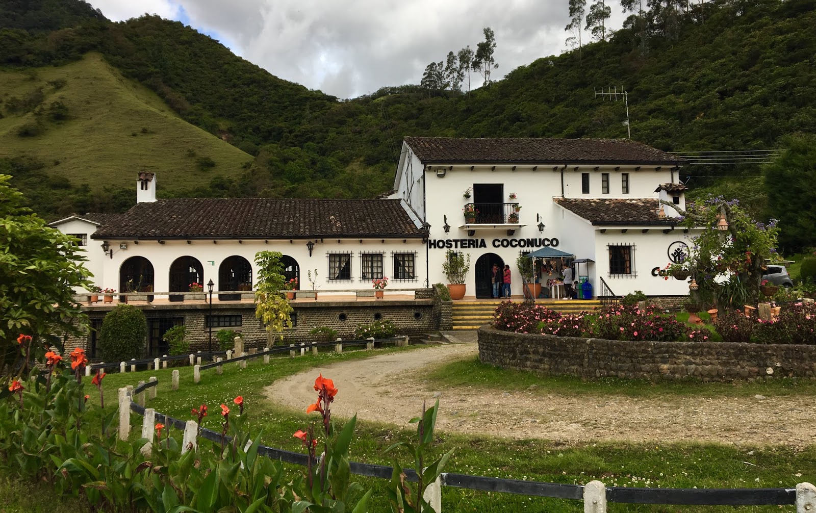
Hostería Coconuco - a great Puracé base

Around Km ~23 is the turnoff for Pilimbalá, a small outpost run by some local indigenous people (eBird Hotspot). There is rustic lodging available at Pilimbalá, but I think it is an option only for the very adventurous, particularly with the more comfortable Hosteria Coconuco only 45 minutes away. At Km 26 is the famous Condor Rock ('La Piedra del Cóndor', eBird Hotspot) where locals have long been putting out food for Andean Condors at 10am each morning. With enough patience, the incredible birds will sometimes make an appearance. The condor's 11-foot wingspan make the associated Black Vultures, Crested Caracaras, and Carunculated Caracaras look like sparrows. As the photos will attest, the views are stunning. A visit to Condor Rock is a once-in-a-lifetime-type event, so don't miss it. And bring your camera!

Andean Condor at Puracé
Canon 500mm f/4 IS + 1.4x III on EOS 7D Mark II
1/2000 at f/5.6, ISO 800

Since the condor action doesn't begin until 10am, my suggestion is to get a really early start and drive all the way to Termales de San Juan at Km 37 (eBird hotspot) for some early morning birding before the condors. Besides great páramo birding (11,242ft / 3,426m) there are some really beautiful volcanic hot springs just half a mile down the main San Juan trail. Swimming isn't permitted, but the views are certainly worth the walk. You might just find Andean Teal lounging in the thermal pools or Noble Snipe poking along the soggy edges. Other birds we encountered on the hot springs trail included Pearled Treerunner, White-browed Spinetail, Brown-backed Chat-Tyrant, Black-crested Warbler, Lacrimose Mountain-Tanager, Golden-crowned Tanager, and Blue-backed Conebill.
Volcanic springs at Termales San Juan in Puracé

After the condors, I'd return to the páramo for more high elevation birding. Exploring the area around Laguna San Rafael (eBird hotspot), we found Tawny Antpitta, Agile Tit-Tyrant, Scarlet-bellied Mountain-Tanager, Mountain Wren, Páramo Tapaculo, and Pale-naped Brushfich. We also heard Crescent-faced Antpitta, one of the most reclusive birds in the entire country. The road into and out of Puracé makes for great birding, and it's so lightly trafficked enough that birders can stop and explore whenever they want. I easily could have spent two full days at Puracé. 

Puracé páramo

Puracé waterfall

Bosque Leguaro
Boque Leguaro a private finca just outside Coconuco and couples perfectly with a visit to Puracé, particularly the morning after a full day (or two!) at the national park and an overnight at the Hostería Coconuco. There is no eBird Hotspot for Bosque Legaro (yet!), but this eBird spot is right at the end of the driveway and essentially marks the turn into the finca (map below). Be sure to check the river for White-capped Dipper and Torrent Tyrannulet before heading up to the finca. The house has both hummingbird and fruit feeders, but birders should first head upslope behind the house. There is no trail, so the best thing to do is wander through the pastures and scan the forest edges for feeding flocks. Using that strategy, we found Crimson-Mantled Woodpecker, Barred Becard, Mountain Wren, Golden-rumped Euphonia, Chestnut-capped Brushfinch, and Blue-and-black Tanager. Most importantly we found Cinerous Conebill, Rufous-chested Tanager, and Golden-plumed Parakeet, three mid-elevations species that can be tricky in that area (those species can sometimes be found along the steep/unpaved 2 Km bottom section of the Puracé road as well). Contact Jose Fernán at bolimosquera@gmail.com to arrange a visit to Bosque Leguaro. There is small fee, but it's totally worth it. Plus, you'll be supporting people at the most local level possible if you visit!


Sparkling Violet is common at Bosque Legauro
Canon 500mm f/4 IS + 1.4x III on EOS 5D Mark IV
1/320 at f/7.1, ISO 1600

Hacienda Versalles (eBird hotspot)
Located off Road 25 towards the southern end of Cauca, just ~18Km before the road crosses into Nariño, this private property is a hidden gem. It is an old ranch house that has been converted into basic but comfortable lodging, and its several dormitory-style rooms can accommodate upwards of 25 people. Home-cooked meals are included and are fantastic. I'd bring bottled water as the tap water is certainly not perfectly clean. While worth a visit in the context of Cauca, the place makes an ideal overnight if you want to continue south into Nariño. Alternatively, it is possible to travel to Versalles, bird it for a day or two, then return to Popayán and/or travel back north to Valle/Cali.


View of ranch house and pool (nice after a morning of birding!)

The birding at Versalles is wonderful and easy. A series of walkable farm roads leads through a dry landscape, and birders alternate exploring open pastureland and surrounding dry forest habitat. Birders might expect to find Blue Ground-Dove, Dark-billed Cuckoo, Black-throated Mango, Grayish Piculet (E), Spot-breasted Woodpecker, Pale-breasted Spinetale, Apical Flycatcher (E), loads of other flycatchers, Scrub Tanager, and Red-breasted Meadowlark. However, the tenderly-diminutive and strikingly-patterned Scarlet-backed Woodpecker is the signature bird for the property. The Upper Patia Valley is the only place in Colombia to see this species, so make sure it's on your radar at Hacienda Versalles!

Views around Versalles (Río Turbio)

Since it is a private property, visiting Hacienda Versalles will take some advance planning. Contact María Alejandra González at patiagon@yahoo.com.mx or at +57 318 803 1254 to arrange a visit. All communication will need be in Spanish, so be ready for that. It might take a bit of work to get everything squared away, but your visit will make the logistics totally worth it. The different habitat will also fluff up your trip list for those that are concerned about that sort of thing.

Summary
OK, that about does it for Cauca. I am sure that there is way more to do than I have presented here, and I hope you'll find some spots of your own to explore. Cauca might take a bit more organization on the front end, but it is a fantastic birding destination that I think all birders will enjoy. One thing to note is the Cauca is NOT a good place for bird photography as there aren't feeder array so to draw birds into worthwhile shooting distance. You'll want you camera for the condor, but otherwise I'd focus on birding in Cauca. If you're really into photography, I'd suggest a few days around Cali, specifically at La Minga and Finca Alejandria (see my last post for info on those spots) .

Damn, that's a lot of info, I hope someone finds it useful!

Next up? Nariño! Stay tuned!